 |
Established Since 1992 Why Buy From 6thplanet ? |
Laminated Office Wall map
of Central London
1020mm x 780mm by Map Marketing
|
|
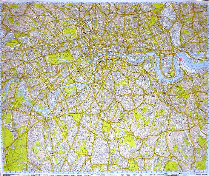
A-Z Central London Street Map
A-Z Central London Street Map - detail This map covers the area of Central London bordered by Neasden, Wimbledon, Elmstead and Wanstead. Fully coloured and showing street level detail, it shows postal districts and borough boundaries and comes complete with a separate index to streets (in booklet form). This map is part of the A-Z nine-sheet series for the whole of London. For further details of this map series, or for information about our bespoke London mapping service, please contact us (details at the bottom of the page). 76 x 102 cm (30" x 40"), 1:21,477(1 mile: 3 inches), laminated |
| RRP 26.99 |

| A Vat invoice will be provided with Vat Shown separately. | Ref : MapUkCenLondon |
| EAN |
Info and Billing
| Payment
Methods Debit Cards - Visa Delta, Solo, Maestro, Electron Credit Cards - Visa, MasterCard, AMEX Also Cheque with Clearance (7 to 10 Working days) |
|